Eswatini Printable Map PDF, JPG, and PNG for Free Download
If you are looking for a Eswatini printable map, you have come to the right place. This map provides a clear and detailed outline of Eswatini (formerly known as Swaziland) without any labels or text, allowing you to customize it as per your need. Whether you require it for educational purposes, travel planning, sketching, or professional use, this printable map is highly useful. You can download it in three different formats – PDF, JPG, and PNG – giving you complete flexibility for usage.
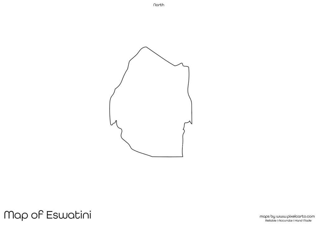
The blank map of Eswatini has been designed with accurate borders, ensuring you get a clear representation of the country’s geographical boundaries. This map does not include any internal labels, city names, or divisions, making it ideal for labeling, sketching, or adding custom content according to your project. Whether you are a student, teacher, traveler, or researcher, this map will fulfill your purpose.
Why Should You Download a Printable Map of Eswatini?
A printable map of Eswatini is highly beneficial for different purposes. Since it comes without any text or labels, you can use it for customization as per your requirement. Whether it’s for educational, travel, sketching, or research use, this map offers complete flexibility.
Educational Use
Teachers and students often need a blank map of Eswatini for educational purposes. Teachers can use this map in the classroom for map labeling exercises, quizzes, and assignments. Students can also use it for school projects where they need to mark cities, rivers, borders, or major landmarks of Eswatini. This printable map makes it easy to understand the geography of the country.
Travel Planning
Travelers planning a trip to Eswatini can use this map for marking their travel routes, popular destinations, and places of interest. Since the map has no pre-labeled content, travelers can customize it by adding important locations such as hotels, tourist attractions, and transportation routes. This map is also helpful for travel bloggers and content creators who want to showcase their travel plans.
Sketching and Artwork
If you enjoy sketching or working on creative projects, this map of Eswatini outline is ideal for your artistic needs. With no internal labels or distractions, you can freely draw, color, or design the map as per your preference. It is highly recommended for art projects, map sketching, and creative customization.
Research and Documentation
Researchers working on projects related to Eswatini may require a blank map for documentation, data visualization, or report creation. This map allows researchers to customize it by adding research-based content such as resource points, population data, or geographical findings. It is perfect for professional presentations or academic research.
Business Planning and Site Marking
Business professionals planning operations or setting up new projects in Eswatini can use this map to mark project sites, office locations, or supply chains. The Eswatini printable map offers a clear border outline, allowing businesses to create visual presentations without any distractions. This map is beneficial for business research, project mapping, and business planning.
Available Formats for Eswatini Printable Map
The Eswatini printable map is available in three different formats – PDF, JPG, and PNG – allowing users to choose the format that best suits their purpose. Each format comes with its unique benefits, making it easier for different users.
Eswatini Printable Map PDF
The PDF format is ideal for high-quality printing. If you need the map for school assignments, presentations, documentation, or large-scale printing, the PDF format is the best choice. It provides high-resolution quality, ensuring that the map remains clear even after printing in large sizes.
Benefits of PDF format:
- High-quality resolution for printing purposes.
- Easy to scale or resize without quality loss.
- Best for educational and professional use.
Eswatini Printable Map JPG
The JPG format is widely used for digital content. If you need the map for online presentations, social media content, or website graphics, downloading the JPG format is ideal. It is lightweight, easy to download, and can be shared quickly.
Benefits of JPG format:
- Lightweight and easy to download.
- Perfect for online content, blogs, and presentations.
- Quick to share and access on different platforms.
Eswatini Printable Map PNG
The PNG format is highly beneficial for graphic designers and content creators who need the map with a transparent background. This format allows users to overlay the map on other designs, infographics, or presentations. It is perfect for graphic design work.
Benefits of PNG format:
- Transparent background for customization.
- High-quality resolution for graphic content.
- Best for presentations and design projects.
Location of Eswatini on the Map of Africa
Eswatini is a small country located in Southern Africa. It is bordered by Mozambique to the northeast, South Africa to the north, west, and south, and is situated near the Indian Ocean coastline. The country is known for its diverse culture, scenic landscapes, and wildlife parks.
The capital city of Eswatini is Mbabane, while the largest city in the country is Manzini. This map helps users understand the geographical location of Eswatini on the map of Africa and how it connects with its neighboring countries.
Understanding Eswatini’s location is essential for students, travelers, and researchers who wish to explore the country or study its geographical boundaries. This blank map of Eswatini helps in understanding its position on the African map.
Why Is This Printable Map of Eswatini Recommended?
The Eswatini printable map provided here is designed with high accuracy and a clear border outline, ensuring it is useful for various purposes. Since the map does not contain any city names, roads, or internal divisions, it offers complete customization freedom.
Here’s why you should download this map:
- It comes in three different formats – PDF, JPG, and PNG.
- Provides a clear and accurate border outline of Eswatini.
- Allows you to customize it for labeling, sketching, or content creation.
- Suitable for educational, travel, research, or business use.
- High-quality resolution ensures clear printing or digital usage.
This map is ideal for teachers, students, travelers, content creators, business professionals, and researchers who need a blank map of Eswatini for their personal or professional use.
Final Thoughts
A Eswatini printable map is a highly versatile tool that can be used for various purposes, including education, travel planning, business research, artistic projects, and professional documentation. Since this map does not include any pre-added labels, you have full freedom to customize it as per your need.
You can download this map in PDF format for high-quality prints, JPG format for online use, or PNG format for graphic design purposes. The map is clear, accurate, and distraction-free, making it suitable for labeling, sketching, or content creation.
Whether you are a teacher, student, traveler, researcher, business professional, or artist, this Eswatini printable map is perfect for your needs. Download it today and start using it for educational, travel, research, or personal purposes.